“Public Housing Projects, 19th Street and Division, One Block East of Pruitt-Igoe Just West of Carr Square Village,” 1954, Arthur Witman Collection (S0732). S0732-581. The State Historical Society of Missouri, Photograph Collection.
Issue 33, Spring 2022

The Material World of Modern Segregation St. Louis in the Long Era of Ferguson.

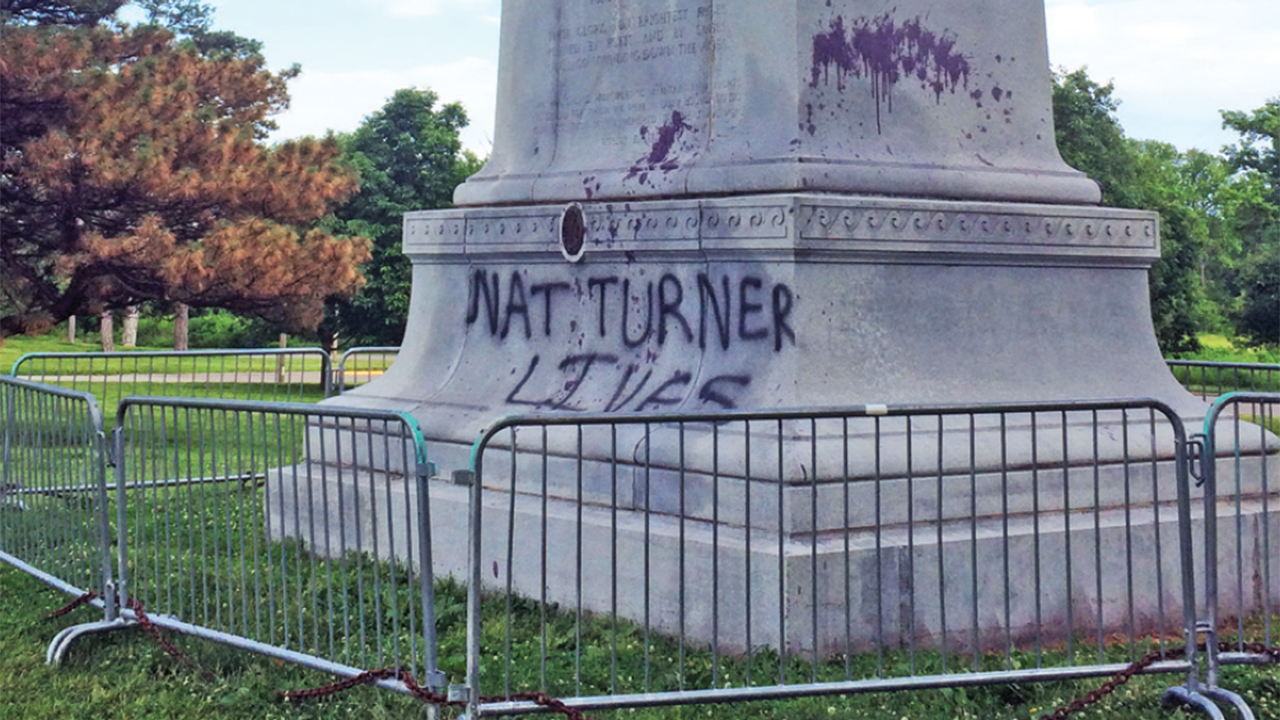
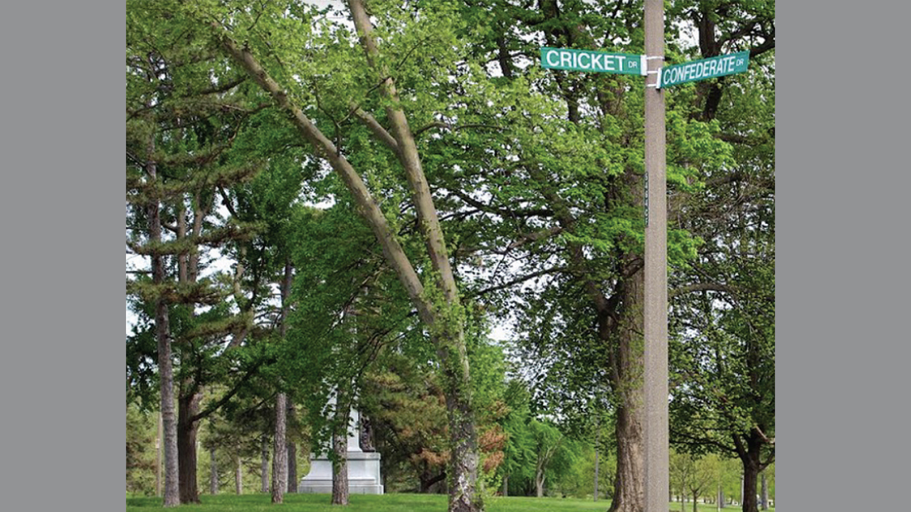
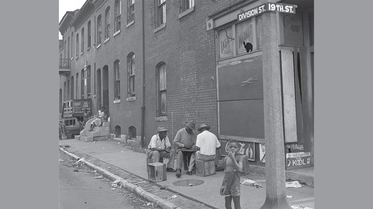
Introduction: 19th and Division, 1954

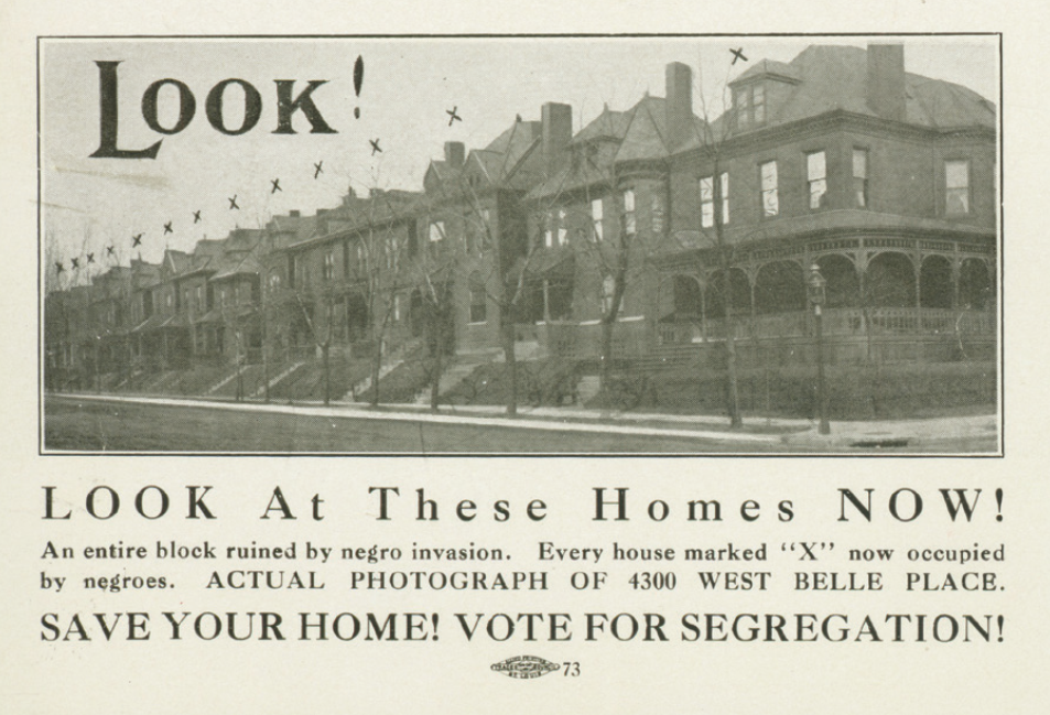
The illusion conjured by modern segregation is that segregation is a totalized reality, a natural and normal state of affairs. It is only by the close visual and historical engagement with material sites of segregation as palimpsests, in the manner this volume models, that the precariousness of the segregationist project in St. Louis can be discovered.

Memorials on the Move

The controversy surrounding the Confederate Memorial’s June 2017 removal from Forest Park once again placed St. Louis squarely within a movement that encompassed dozens of communities around the nation. As these disparate outcomes demonstrate, such campaigns manifested not only as binary debates over whether contested monuments should remain visible, but also where they might properly be located and how they might be repurposed to convey historical lessons about the relationship between symbolic landscapes and larger systems of racial oppression.

Claiming the Past, Possessing the Park

As the aesthetics of the Confederate Memorial at St. Louis’s Forest Park laid claim to a particular narrative about the Civil War, written and visual evidence reveals how Confederate sympathizers, from the initial dedication of the monument to subsequent celebrations, utilized highly visible rituals to assert control over the site and its surroundings. It was through such events—along with news coverage of them—that Confederate boosters and the media alike defined a racialized sense of ownership over an obelisk in the center of a public park. The monument was one and the same an assertion of power over history and city space.

Sighting Segregation

From De Andrea Nichols’s Mirror Casket to Damon Davis’s All Hands On Deck to the lawn sculptures of Hands Up each work’s materiality disrupted the naturalization of segregated anti-Black space in St. Louis and produced embodied strategies of reclamation.

The View from the Eads Bridge

From its 1874 opening through the 1980s, when East St. Louis became equated with Blackness and crime, the Eads Bridge became an experimental zone, where racist geographic imaginations clashed with liberal fantasies of multiculturalism. On the Eads Bridge, we see the apparatus of hegemony at work, trying to fit all the bridge represents into the nation’s founding myths.

Delmar Boulevard

St. Louisans have for a century conferred upon this long, otherwise-unremarkable commercial thoroughfare an almost talismanic power to define the bounds of their racially-identified communities. In the process, the more complex reasons for its status as a marker of racial difference—reasons rooted in the city’s geography, shored up by the real estate market’s desire for predictability, and sealed in place through generations of social antipathy or simple inertia—have disappeared under a veneer of geographic inevitability.

Powell Hall

The “Requiem for Mike Brown” protest of 2014 engaged Powell Hall’s history in deep and provocative ways that went beyond the brief disruption of an evening of high culture. The protesters insisted on concern for Black lives in a building that, as the St. Louis Theater, had excluded African Americans. They questioned the troubled relationship between police and Black St. Louisans in a venue whose rebirth as a symphony hall hinged on the promise that police would protect its patrons from the city outside.

The Wellston Loop Pavilion

It is worth revisiting the summer of 1967, elsewhere hailed as the “summer of love,” but in Wellston a pivotal moment when the broader stakes of this community’s struggles were boldly articulated, fought out against the backdrop of the Loop Pavilion and commercial strip, and the long-term outcomes of those struggles were far from visible. . . The epicenter of conflict was a lawn statue, a monument controversy writ small that revealed much about the larger political stakes of the moment.

The Long Reconstruction of Fairground Park

Today, the traumatic histories of Fairground Park lie concealed beneath an active landscape of public recreation frequented by Black St. Louisans. There are no monuments or markers to teach the story of the 1949 pool riot, although the outline of the old pool still reveals itself in aerial photographs. Fairground Park has been witness to the ways in which the state can make bare lives and bare spaces, not through hard laws but through soft powers, practices and exclusions buried in the hidden transcripts and code words of powerful White actors.

The Seeds in North County

What is Christ the King United Church of Christ, then, and how do we understand its history and current form as part of a living narrative of urban segregation? Current members, committed as they are to the progressive political witness and focus on a ministry to the African-American community, are not just about that. The congregation claims all of its history: German, White, liberal Protestant, spirit-filled, and unashamedly Black.

Amplifying History

Sound, like a bullet, travels, and at sufficiently high decibels can penetrate the flesh of its target. The damage inflicted by sonic weaponry such as the Long-Range Acoustic Device (LRAD) is real and measurable, both physically and psychically, and its racialized genealogy can be traced back to anti-Black White mobs of the late nineteenth and early twentieth centuries, and in particular the World War I era.

On the Surface of Things

The basketball court in St. Louis Place Park sits just one block east of ninety-nine acres blighted by St. Louis City for the relocation site of the National Geospatial-Intelligence Agency. Like the neighborhood that surrounds it, the black-top has been allowed to fall into disrepair over the past several decades. Similar courts have long served as important social and recreational spaces for Black communities in urban areas across the United States, but this particular court in North St. Louis continues to bear witness to the dispersal and erosion of Black community.

The Climate of Cook Avenue

In 1912, White residents faced “a negro invasion”: three Black families had purchased homes on the 4000 block of Cook Avenue, including the Hudlin family that May. The action of this Black family moving into “White space” would prompt armed self-defense, police intervention, and changes to the law. The system of de facto segregation that protected property values and racial hierarchies was being legally transgressed.

Love Bank Park and Gentrification on Cherokee Street

St. Louis’s urban crisis happened along deeply divided lines of race and class, and so is its economic and spatial reinvigoration happening along those same lines. In many ways, the Cherokee Street district, the neighborhoods surrounding it, and Love Bank Park are unique urban arenas that reveal the pains of growth and decline in St. Louis, but they are also situated at the typical boundaries one might find in American cities of the twenty-first century.

This Home is Not For Sale

Like St. Louis Place as a whole—a neighborhood so beleaguered and yet so beloved—the grassy lot at the 2300 block of Mullanphy on the near side of North St. Louis manifests many characteristics that can also be found in other predominantly Black neighborhoods across the St. Louis region, from the Ville to Howard-Evans Place to Kinloch, each of which has been subjected to threats from those who would seek to extract their value and expunge their negative associations. At this particular site, the negative and positive have become fatefully entangled, and yet residents have found ways to express its emancipation-heritage significance.

Howard-Evans Place

The only physical reminder that Howard-Evans Place once existed is a boulder with a commemorative plaque at the back entrance to The Promenade at Brentwood shopping center, which now stands in the neighborhood’s place. Purchased with Brentwood City funds as a gesture of goodwill, the boulder instead generates hard feelings among some former residents and stands as a cold reminder that a large part of Brentwood’s history was razed for retail.

The Façade of Redevelopment

So what are the tools and ideas that made it ok—at least from somebody’s perspective—to remove hundreds of people from their homes under claims of progress and revitalization? What made it ok to level affordable, multi-family units that were so well-made and so important to the city’s history of industry and labor that they were listed on the National Register of Historic Places? And then to replace them with cheap construction of larger, more expensive, single-family homes? Why does wholesale clearing persist if we know, based on the lessons long learned and documented, from redlining and urban renewals to predatory loans, that clearing and exploitation are forms of racial injustice?